Garmin GPSMAP 1222, non-sonar, Worldwide
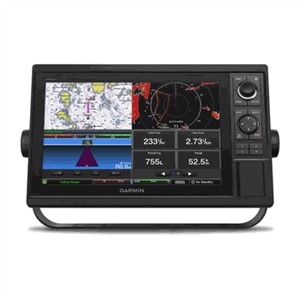
The Garmin GPSMAP 1222 is a 12-inch marine chartplotter from Garmin's large-format keyed/touch helm display range, built for flybridge and command-station installations on mid-size to larger powerboats and sailboats. This specific configuration is the non-sonar variant -- it ships as a pure chartplotter with no internal sonar module fitted, intended for boats that already have dedicated sonar/fishfinder hardware elsewhere on the network or that don't need fishfinding at all -- and it comes preloaded with Garmin's Worldwide Basemap for global coastal reference right out of the box.
On the water, the 1222 acts as the primary navigation display at the helm: a 12-inch, high-bright, sunlight-readable screen paired with physical keys and a rotary control knob for glove-friendly operation in rough conditions, backed by a high-sensitivity internal 10Hz GPS/GLONASS receiver for smooth, responsive position tracking. It networks with the rest of the boat over the Garmin Marine Network, NMEA 2000 and legacy NMEA 0183, and adds built-in Wi-Fi for the free ActiveCaptain app plus ANT wireless for pairing a quatix marine watch, Garmin Nautix in-view display, gWind Wireless 2 transducer, GNX Wind instrument, or wireless remote controls. Chart detail can be extended by inserting an optional BlueChart g2 Vision HD or BlueChart g3 card for Auto Guidance routing and richer harbour data. Box typically includes the display unit, sun cover, and mounting hardware; power/data cabling and any sonar module are sold separately given this is the non-sonar SKU.
Online price incl. VAT
Availability: Stock available — ships within 1-3 business days
Display
- Screen Size: 12-inch diagonal, color TFT
- Interface: Physical keypad with rotary control dial (keyed model)
- Visibility: High-bright, sunlight-readable
Navigation
- GPS Receiver: Internal high-sensitivity GPS/GLONASS, 10Hz position updates
- Preloaded Charts: Worldwide Basemap
- Optional Charts: BlueChart g2 Vision HD / BlueChart g3 (Auto Guidance)
- Sonar: None fitted (non-sonar configuration)
Connectivity
- Networking: Garmin Marine Network, NMEA 2000, NMEA 0183
- Wireless: Built-in Wi-Fi (ActiveCaptain app); ANT wireless for quatix watch, Nautix, gWind Wireless 2, GNX Wind, remotes
General
- Brand: Garmin
- Product Type: Marine chartplotter (keyed, non-sonar)
- Coverage: Worldwide